| Back | Home | ||
| GIS MAPS & IMAGES | ||
 |
 |
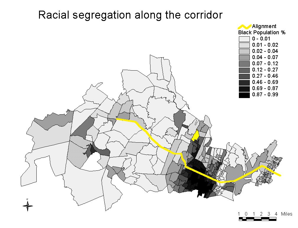 |
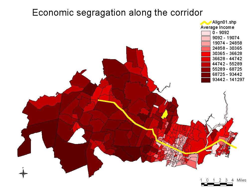
| LAND-USE AROUND ALIGNMENT | ECONOMIC SEGREGATION ALONG ALIGNMENT | RACIAL SEGREGATION ALONG ALIGNMENT |
|
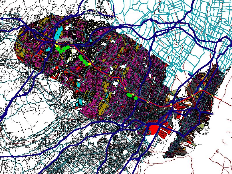
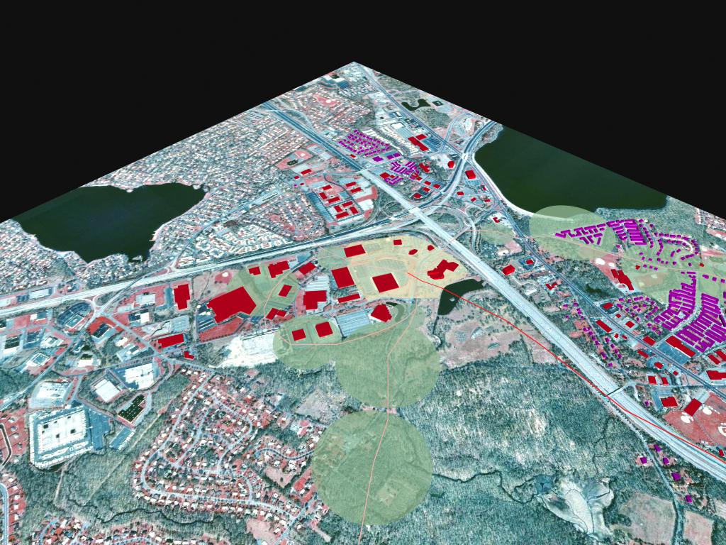
AERIAL IMAGES OF NJ LINEAR CITY & LEGEND DIAGRAM (BELOW) |
||
|
||
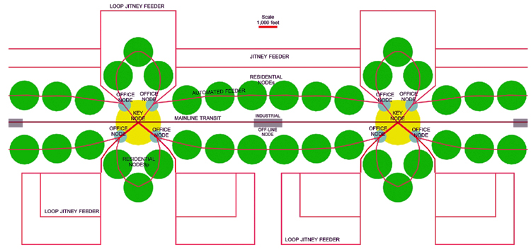
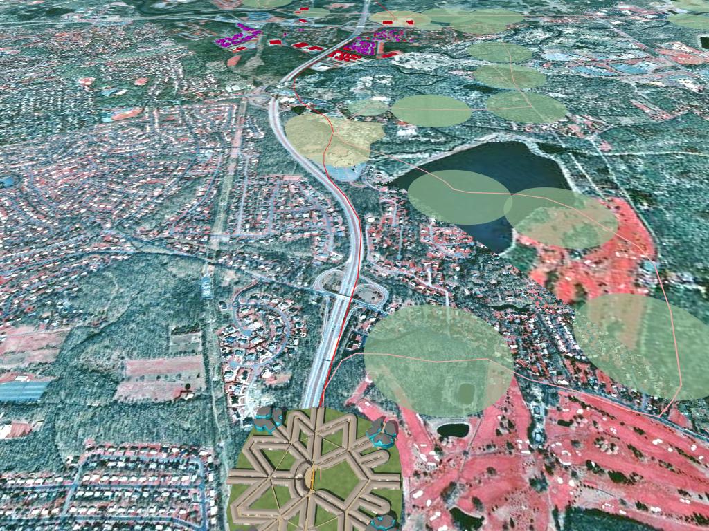
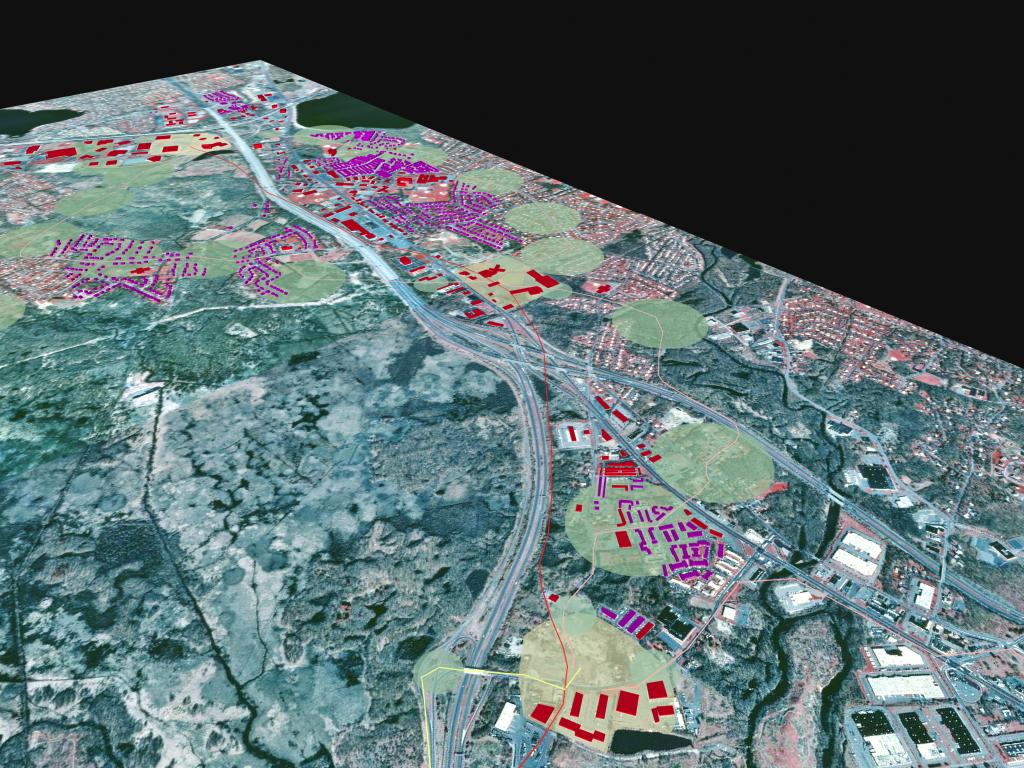
| HOW TO READ THE IMAGES BELOW: Auto-free Station areas (yellow, “Key Nodes”) of the Morris-Essex Rail Express. these station reinforce existing commercial activity centers (red buildings). Notice the inter-station feeder routeS (pink), the partly-auto-restricted residential station areas (green, “Residential Nodes”) and the remote parking facilities at the first stop of feeder routes (cyan, “Office Nodes”). | ||
 |
 |
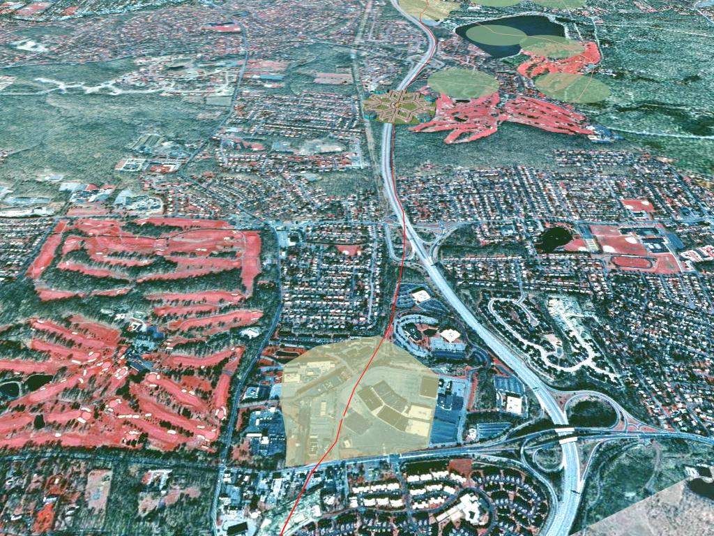 |
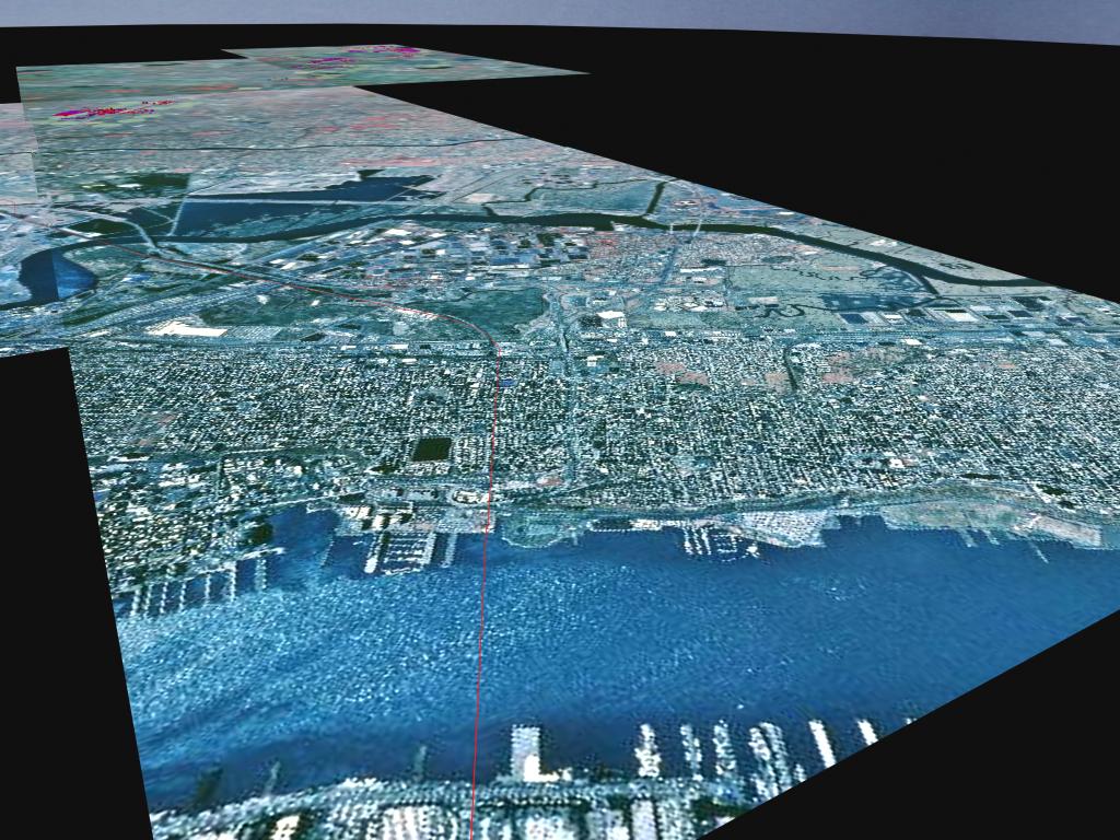
| FROM BOTTOM-UP: MANHATTAN (AROUND 42ND STREET), HUDSON RIVER, NEW JERSEY | LOCATION OF AUTO-FREE STATION AREAS IN HIGH DENSITY AREAS ALONG I-280 | NEW AUTOFREE STATION AREA AT CENTER OF A SUBURBAN MALL (CURRENTLY WITH 70% SURFACE DEDICATED TO PARKING). |
 |
 |
 |
| AUTO FREE STATION AREAS IN LOW-DENSITY MORRIS COUNTY | MORRIS COUNTY TERMINAL | |
 |
 |
|
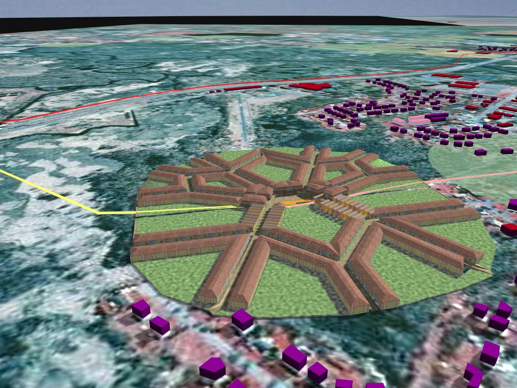
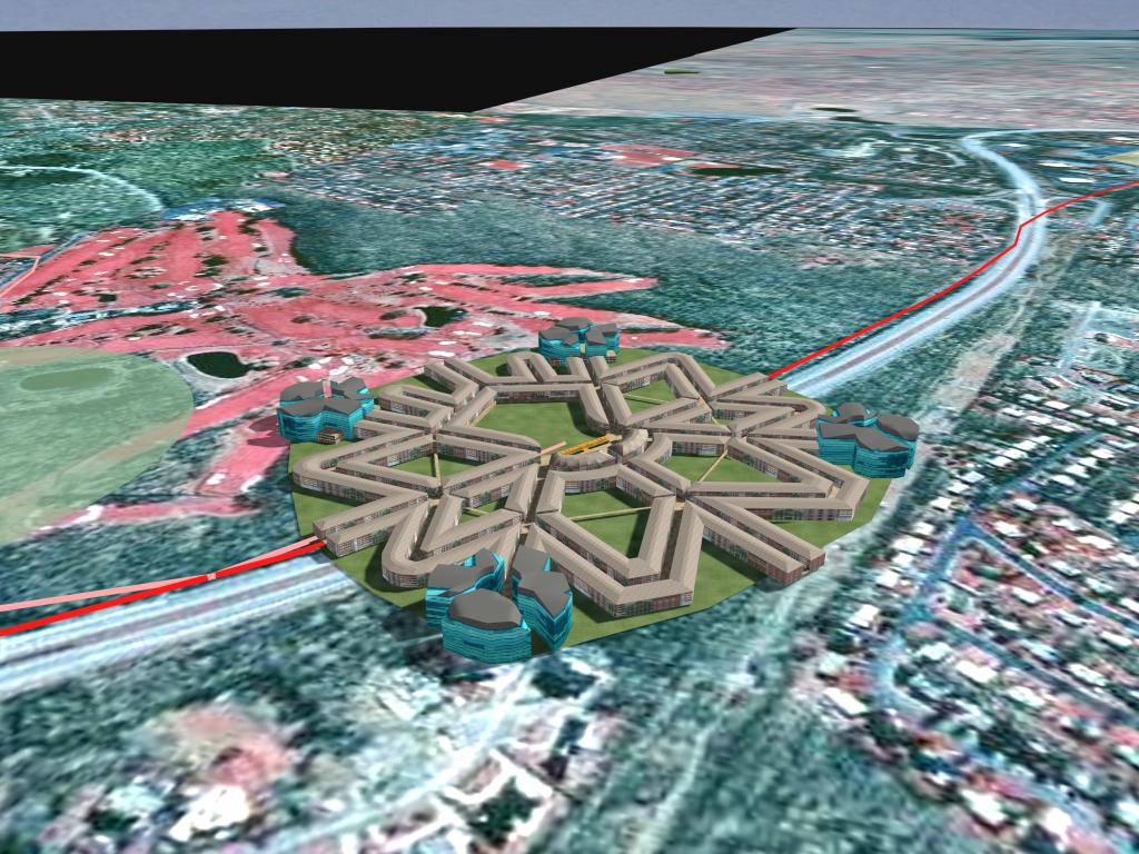
| ONE OF POSSIBLE RESIDENTIAL NODE DESIGNS FOR (UNCOMMON) FEEDER-ROUTE GREENFIELD SITES | ONE OF POSSIBLE KEY NODE DESIGNS FOR (UNCOMMON) MAINLINE-ROUTE GREENFIELD SITES | |