|
|
Design of Station Districts in PLC
The three dimensional spatial distribution of transportation
networks/nodes and indoor/outdoor urban activities is crucial to the
maximization of each others’ utilization and, therefore, their potential regional economic
value. This is especially true within what we’ll define as “ station district
core areas”, i.e. areas within 200-300 feet of a transit node.
The spatial and network integration of different
transportation modes within the built environment is essential to maximize
accessibility and quality of spaces, while minimizing negative proximities and
environmental impacts.
Careful and detailed design (or re-design) is required of
station district core areas, since they are the most valuable land and they act
as gateways to the rest of the district. In fact, their utilization should be
maximized while maintaining very high accessibility to the larger station
district and beyond.
The very low noise and vibration levels of modern transit
systems allow the integration of the guideway directly adjacent to commercial,
retail and office spaces. These can be additionally reduced by sound barrier,
even transparent ones, and by the isolation of guideway structure elements.
These engineering methods are regularly implemented in many airport APM
systems, where the benefits of reduced environmental impact justify the
additional costs.
I will here analyze what would be the impact of limiting
auto-access and parking to Office nodes, while keeping most Residential and Key
nodes auto-free.
Eliminating very large facilities needed to route and park
autos in such high capacity nodes, a large quantity of quality urban space
around stations would open to more direct utilization.
As it happens in many US metros, these facilities consume
valuable core area space, create barrier effects and generate high
environmental costs on surrounding urban space.
All district types can be developed as green-field,
brown-field or infill developments according to existing conditions and
opportunities.
|
 |
 |
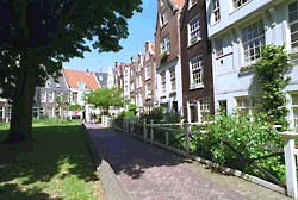 |
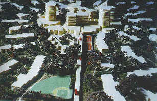
| Figure 4: (From top) 2
pictures of what
an auto-free transit village could look like. (By Roxanne
Warren's book "Urban
Oasis'). Residential districts residences could develop around courts, as in an Holland (photo by
Crawford Systems). |
Residential Districts
Except for the first station, which will be designed as
Office district, I will refer to any district surrounding Feeder stations as
residential nodes. In fact, their specific placement within the transit network
makes them relatively less accessible than office and key districts; therefore,
most of these districts would host residential neighborhoods or large institutions
for which high accessibility is relatively less important (university campuses,
sport facilities, etc.).
Due to time constrains, I will only analyze an ideal
scenario of a new station in a green-field site in a typical single-family
residential neighborhood. I will discretionally pick a block size of 300’x800’.
Aside for exceptional local conditions and opportunities,
the auto-free area should cover at least 4-500’ from the station and,
preferably, extend to the edge of the district. This distance is minimum to
preserve urban space and its environmental quality. Auto users can access the
multi-modal system quicker through the high performance auto/transit intermodal
facilities at office nodes.
|
Office Districts
|
|
|
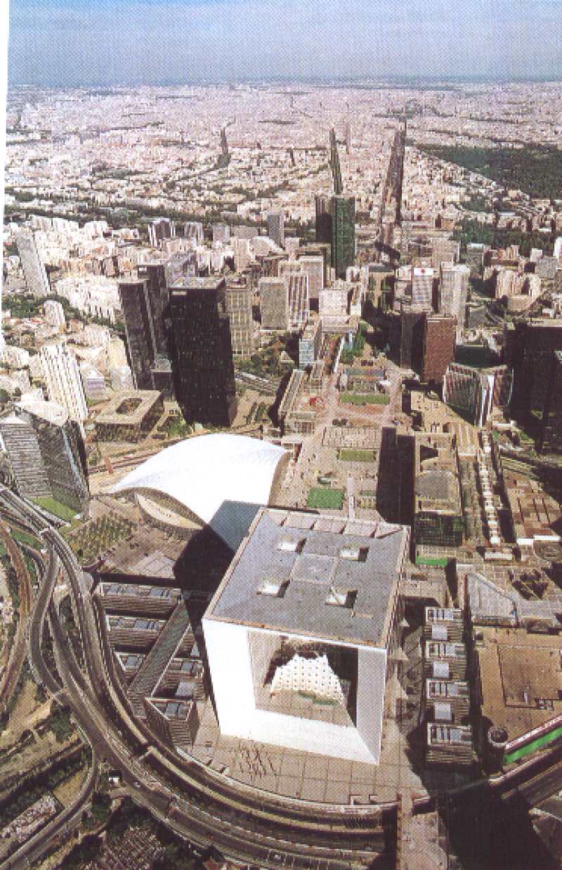
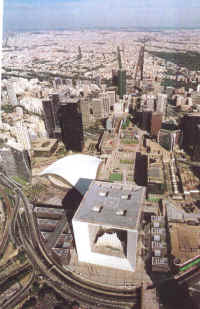
La Defence in Paris is a good
inspiration for the office district. See how parking and
roads can form pedestal for an office plaza development.
|
Being the first station on the feeder system to/from a key
node and switching point of different feeder routes ( 2 or more), its regional accessibility is very high. Its placement respect to key node should be of
about 1,000 to 1,500; this way riders can choose to walk the distance to take
advantage of activity opportunities along major key node boulevards.
Provided its location near a major highway interchange, this
is the ideal place for auto-transit and transit/auto transfers. In fact, hourly
auto rental facilities could offer rental to non-car owners.
In turn, exceptional highway and transit access make this
node ideal for all many activities that require large regional pools of potential
costumers, employees and suppliers. High-valued activities, such as legal,
financial, accounting, high-tech do not require the stop-and –go accessibility
of key nodes.
Comparatively, employees/costumers of these activity types
value more the ability to choose among many employers/providers within a
region.
The physical design of the office node must integrate a
demanding auto-to-transit hub with much office space, while taming the
environmental effects of auto transfer and parking. The placement of office
districts at the edge of key districts largely reduces concerns about shadow
casting over valuable areas.
Following these last two considerations, a solution could be
a partly submerged parking structure over which high-rise office buildings
surround an elevated station plaza. This way, feeder system would connect to
the 3-5 stories parking structure at its very center, reducing the transfer
time from the owned-auto to transit and from transit to rental-auto.
The large parking facility, easy regional highway access and
easy direct accessibility from residential and key districts also make it ideal
for hourly auto rental establishments. Mostly, PLC residents and all other
non-car owners would use the facilities to access low-frequency regional
activities, as well as social, weekend and inter-urban trips.
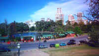
KEY DISTRICTS
Key nodes, being the most
accessible, would constitute the centers of PLC. At a 60 seconds
frequency, 50,000 to 80,000 people would be pass through the node at each
peak hour. Each passing traveler could stop any key station for an activity or
errand; easily get back on after 30 seconds wait and continue for their
destination. These opportunities make key stations ideal for stops while going
from home-to-work or work-to-home. Most would be retail, light entertainment.
Arrival at the key station could resemble arriving at the center of a large open
air square at the center of huge mall. Their high regional accessibility,
especially within PLC, makes them ideal as employee intensive and costumer
intensive services.
As a commercial center, it should
provide large amounts of retail space, which ideally should be visible and
easily reachable from the transit station.
As a social center it should
provide opportunities for interaction, entertainment, people watching.
As the center of civic life, it
should provide appealing and functional public space, where people could gather
to participate in desired activities.
|
|
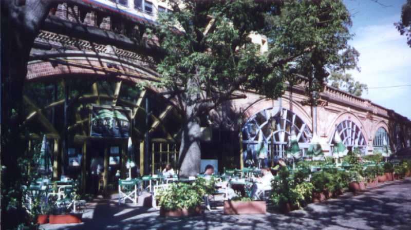
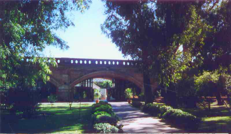
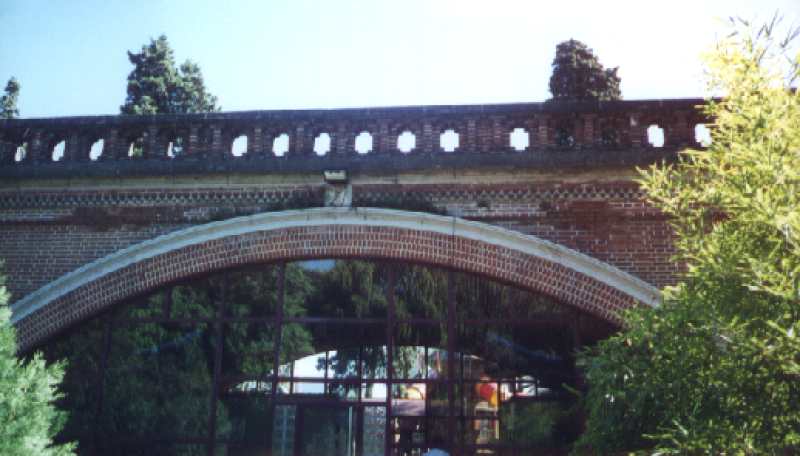
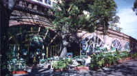
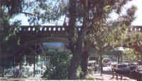
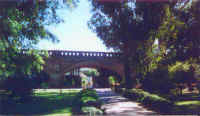
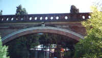
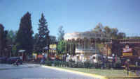
Following
are some pictures of the "Le Rosedal" park in Buenos Aires
Here, a commuter rail line has been integrated into the landscape and
within commercial and entertainment activities.
Taking advantage of its great natural settings and architectural
quality, a variety of activities are housed under the guideway:
restaurants, cafes, light manufacturing, retail, night clubs. The rail
system is not any quieter than other old rail systems. Its daily
frequency, however, is about 2-3 trains per hour. |
 |
 |
 |
| See the train passing over a
cafe'. |
See how an arterial road, a
guideway and a cafe' can be integrated. |
At a certain point the guideway
is hidden by an artificial hill, which provides this view of the park. |
 |
 |
 |
| How pedestrian and bicycle
paths interfaced with the guideway. |
Guideway detail. |
Kids' playground around the
guideway. |
|